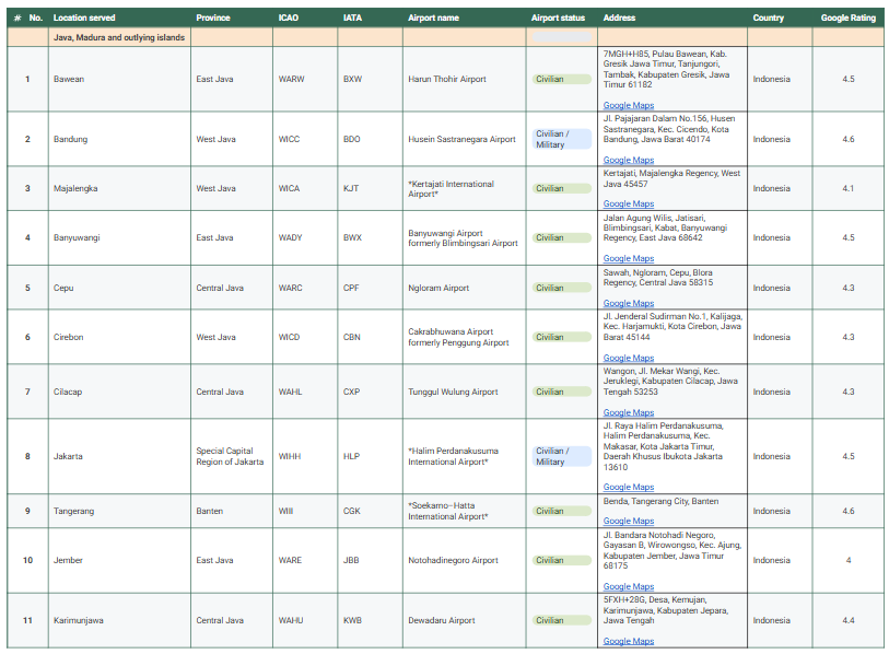
I created a comprehensive dataset of 184 airports in Indonesia, structured by region and enriched with practical details. The project started with an imported list from Wikipedia using the =IMPORTHTML formula in Google Sheets. I then manually researched and added addresses, Google Ratings, and Google Maps links for each airport.
What I Did
- Compiled 184 airports across 7 regions in Indonesia.
- Collected ICAO/IATA codes, location served, province, airport status, and country.
- Enriched the dataset with addresses, Google Ratings, and direct Google Maps links.
- Cleaned and simplified the dataset by removing incomplete fields.
Why It Matters
This dataset can be used for:
- Aviation research → understanding airport distribution and accessibility.
- Travel & logistics planning → practical reference for businesses and travelers.
- Mapping & visualization → integrating addresses and ratings into dashboards.
- Education → resource for students studying geography or aviation.
Outcome
The final dataset is a clean, structured, and enriched resource, showing my skills in data research, enrichment, validation, and organization.
Want to see the full process, methodology, and detailed report? See below document.